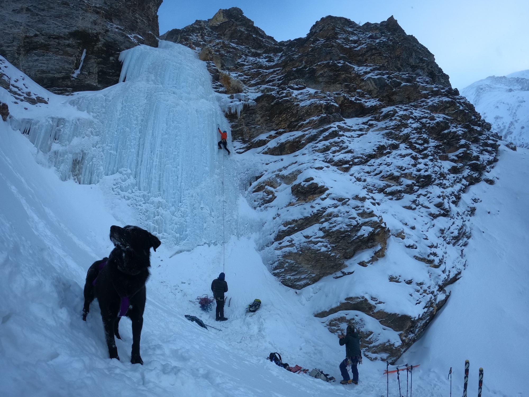
Rating: WI4
Length: 30 meters
Route is steepest at the start then tapers out after the first 10-15 m. In the early season before the pillar has touched down at the base, there is ice on the left which can be climbed. If you take this route be prepared for a traverse right half e at up the climb.
FA:
Descent: There are options either for a walk around or a v-thread descent. The walk around is to the left at the top of the climb. Can be steep and icy. So a v-thread rappel is probably a better option.
Posted by: Stefan Johnson, December 14, 2021.
Lat/Long: 63.525543/-145.8120304 Approach is a 3km walk up Gunnysack creek. Be prepared for a bit of a slog, especially early season. Gunnysack 1 is found a few thousand feet before Gunnysack 2. The only real obstacle on the approach is a narrow part of the creek constricted by boulders on either side. Be prepared to scramble around either side as the ice is rarely stable here.
Send us your video of this climb.

The grid on the approach tab is not correct. Its about 1/4th a mile past that grid
This information comes second hand. Would you be willing to help us get the route coordinates?
This was the only climb I found definitive evidence of a previous ascent in the area in the 90’s. There was an army piton for a rap anchor…though walking off is fine.
Bit of history, bit of tat
Looking at the location map
Should go:
East to West
Gunny 1
Go tell it to the Mountain
Hanging Chad
Gunny 2
I.E. Just change the links/labels
Thanks, Hebrew. Not sure what you mean. Are you suggesting that Gunny 1 is the furthest up river? Our coordinates for these routes match location descriptions. Maybe those are wrong?
I mean west to east…am dyslectic(sp). Gunny 2 is furthest up creek.